
Der Einkaufskorb ist noch leer.
|
Wales Coast Path 4: Llanelli to Chepstow - Including Gower Peninsula 1:40 000 National Trail - HARVEY MAPS [Wales Coast Path 4 - National Trail Map]
|
Stöbern
|
<< Großbritannien: Wanderkarten, Radwanderkarten und MTB-Karten
<< Harvay Maps
|
|
 | |
Wales Coast Path 4: Llanelli to Chepstow - Including Gower Peninsula 1:40 000 National Trail - HARVEY MAPS
Wales Coast Path 4 - National Trail Map
ISBN: 1851376631
Preis: EUR 23.90
(incl. MwSt.)
|
|
 Blattschnitt Blattschnitt
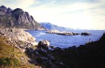
Beispiel
The Wales Coast Path is a 1400km (870 miles) long distance trail that follows, or runs close to, the entire coastline of Wales. It is an incredibly varied trail that offers rugged and unspoilt walking, colourful seaside villages, industrial archaeology, clifftops, beaches and unique heritage sites.
4 HARVEY maps cover the whole of the route. Each map covers a section of the Path suitable for about 2 weeks of walking.
Map 4 covers the Path from Llanelli to the finish (or start) in Chepstow, and includes the whole of the picturesque and popular Gower Peninsula.
Famous for its rugged coastline, cliffs and beautiful sandy beaches, the Gower Peninsula is popular with walkers in its own right. It lies to the west of Swansea. Heading eastwards along the South Wales coast, you will pass through the country`s capital city, Cardiff, before finishing your journey at the estuary of the River Severn near Chepstow.
|
|
Startseite
Allgemeine Geschäftsbedingungen
Kontakt
Impressum
|
|
Dieser Sitzball ...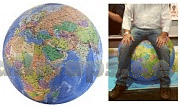
... ist ein detaillierter Globus
Die Welt ist ein Geschenkpapier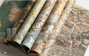
Wandkarten fürs Büro und fürs Heim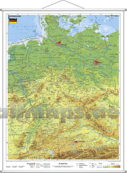
Puzzle-Spiele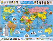
Landkartenpuzzles und viele andere Motive
Schicke Taschen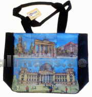
Die Welt aus dem All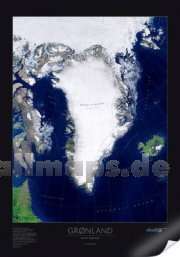
Dekorative Satellitenbild-Poster in gestochen scharfer Auflösung!
Riesengloben zum Aufpusten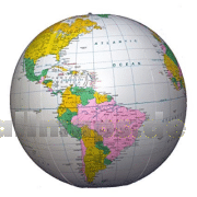
So entdecken Kinder die Welt.
|


 Deutschland
